The city / Rivers and bridges
Twelve bridges,
one river
Wuhan's origin story is a crossing problem. Two rivers split one city into three towns, and for most of its history the only way over was a boat. The first road-and-rail bridge did not open until 1957. By March 2026 there were twelve bridges across the Yangtze — and a thirteenth under construction.
There are twelve road or road-and-rail bridges across the Yangtze in Wuhan, counted to 20 March 2026, with a thirteenth (Hannan) under construction. For a visitor, three matter: the 1957 First Bridge, which you can walk and which carries trains underneath; the orange Parrot Island Bridge beside the Yellow Crane Tower; and the double-deck Yangsigang Bridge, which has a public viewing walkway. The rest are ring-road and motorway crossings you will see from a ferry or a riverbank, not visit.
A guide that lists "the bridges" as one attraction has misunderstood this city. These are twelve different structures built over sixty-nine years for twelve different reasons — a railway, an inner ring road, an expressway bypass, a metropolitan-circle link. Below is each one individually, with what it connects, why it was built, and whether it is worth your time. For how the crossings shape a day, see getting around; for the river itself, see the ferry.
It counts completed road and road-and-rail bridges across the Yangtze within Wuhan, as listed by the Changjiang Daily and Hubei Daily on 20 March 2026 when the Shuangliu Bridge opened. It does not include bridges over the Han River (a separate set we have not been able to count reliably), road tunnels, metro river crossings, or the many bridges over Wuhan's lakes. The thirteenth, the Hannan Yangtze Bridge, was under construction with a reported end-2027 completion. A few secondary sources disagree about individual opening days by a day or two, and about whether Qinghan opened in 2019 or 2021 — we follow the two newspaper lists and the municipal government. See the Changjiang Daily list · Hubei Daily's same list · Municipal government on the first eleven
If you only have an afternoon, see three
The 1957 First Bridge — walk it
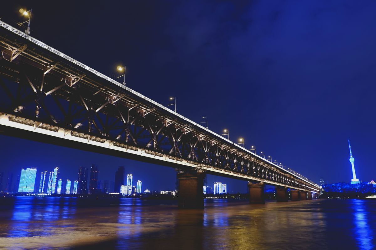
Between Snake Hill (Wuchang) and Tortoise Hill (Hanyang), with a road deck above and the Beijing–Guangzhou railway below. It is the one bridge that is genuinely a sight rather than infrastructure, and you can cross it on foot with the Yellow Crane Tower at one end. Combine it with the tower.
The only unmissable oneParrot Island Bridge — photograph it
The orange three-tower suspension bridge sits close to the tower hill and is the one that keeps appearing in Wuhan night views. Best seen from the riverbank or a ferry rather than driven over. The ferry crossing costs very little and gives you the angle.
Best from the waterYangsigang Bridge — go underneath the statistics
The 2019 double-decker has an official 1,700 m main span and, usefully for a visitor, pedestrian viewing walkways on both sides of the upper deck with eight widened resting bays; the lower deck has a covered walkway and cycle lanes. Municipal government description
The one you can stand onThese three are a judgement, not a ranking published by anyone. The other nine are working crossings: worth recognising from a riverbank, rarely worth a detour.
The twelve, one by one
Each card below has a structural diagram showing the bridge type — a truss, a cable-stayed span, a suspension span, or the double-decker. These are our own drawings, not photographs, and not to scale. We do not have licensed photographs of all twelve bridges, and we will not fill the gaps with an unrelated picture presented as the real thing. Where we do have a genuine photograph, it is captioned separately with what is and is not identified.
First Wuhan Yangtze River Bridge 武汉长江大桥
The first bridge anywhere on the middle Yangtze, and the structure that finally made three towns function as one city. A road deck runs above a double-track railway; eight piers carry it between the two hills. It is the only bridge on this list that is a destination in its own right — you can walk across it, with the Yellow Crane Tower at the Wuchang end and river views the whole way.
The catch: it is the busiest and most photographed crossing in the city, and a full pedestrian crossing is a long, exposed walk in July heat or a damp winter wind.
Second Wuhan Yangtze River Bridge 武汉长江二桥
Thirty-eight years after the first bridge, the second ended the era when all three towns depended on one crossing and created Wuhan's first inner ring. A concrete cable-stayed bridge with a harp of stays, it is the one older residents mean when they talk about the city's night-time river view.
The catch: it is a commuter artery. There is no visitor viewpoint on the bridge itself; see it from the Hankou riverfront or a ferry.
Baishazhou Yangtze Bridge 白沙洲长江大桥
Wuhan's third crossing, upstream of the first bridge and carrying the Third Ring Road. Its red stays made it a minor landmark when it opened. It is the workhorse commuters use between the Hanyang and Wuchang sides.
The catch: secondary sources disagree whether it opened on 8 or 9 September 2000; we follow the 2026 newspaper list. Congestion is a more reliable feature than the colour.
Junshan Yangtze Bridge 军山长江大桥
The outermost south-western crossing, built for the G4 and G50 expressways and the outer ring. It exists for through traffic and freight, not for sightseeing: this is where long-distance vehicles bypass the city altogether.
The catch: it is a long way from anything a short-stay visitor will see. Do not plan a detour.
Yangluo Yangtze Bridge 阳逻长江大桥
Wuhan's first suspension bridge, crossing the river in a single span on the outer ring. Its anchorages were a noted piece of engineering at the time. It serves the port and industrial districts to the east.
The catch: far east of the city centre and effectively invisible from the tourist riverfront.
Tianxingzhou Yangtze Bridge 天兴洲长江大桥
The bridge that took high-speed rail across the Yangtze: it opened on the same day as the Wuhan–Guangzhou high-speed line in December 2009. Road above, rail below, crossed via the mid-river island that gives it its name. If you arrive by high-speed train from the south, there is a good chance you cross it without seeing the river properly.
The catch: it is a transport link, not a viewpoint. The island below is not a tourist stop with visitor facilities we could verify.
Erqi Yangtze Bridge 二七长江大桥
The Second Ring Road's crossing, recognisable by three pylons and three fans of stays — local descriptions read them as three open umbrellas, one for each town. Its job was to take pressure off the Second Bridge.
The catch: one secondary source gives 3 December instead of 31 December 2011; we use the 2026 newspaper list. Best seen at night from the Hankou side.
Parrot Island Yangtze Bridge 鹦鹉洲长江大桥
The orange one. Three towers, four spans, and a location close to the Yellow Crane Tower that puts it into almost every river panorama; it is also part of the Yangtze light-show backdrop. Of the modern crossings, this is the one to make time for — but from the bank, not from a car.
The catch: its colour reads as orange in daylight and in most photographs; Chinese descriptions call it 橘红 (orange-red). The light show runs on a schedule we have not verified.
Zhuankou Yangtze Bridge 沌口长江大桥
A Fourth Ring Road expressway crossing built to move freight and cars around the south-west, with pale blue stays that disappear into the sky. It is the quiet, functional counterpart to its two colourful neighbours.
The catch: an expressway bridge with heavy goods traffic; there is no pedestrian access and nothing to see at the approaches.
Yangsigang Yangtze Bridge 杨泗港长江大桥
The engineering showpiece. A 1,700 m main span crossing the river in one go, the Yangtze's first double-deck road bridge: an upper expressway and a lower city road, twelve traffic lanes in total. The detail that matters to a visitor is the 2 m pedestrian viewing walkway along each side of the upper deck, with eight widened bays, plus a covered lower-level walkway and cycle lanes. Official description of the walkways
The catch: we have not verified current access hours, entry points or whether a passport is needed for the walkway. Confirm on the day before building a trip around it.
Qingshan Yangtze Bridge 青山长江大桥
The Fourth Ring Road's north-eastern crossing, built wide for heavy vehicles and to keep freight away from the urban bridges. Its tall A-shaped towers are a landmark for anyone driving the outer ring, and almost no one else.
The catch: a 2019 date appears in some lists — that was the completion of the main structure, not the opening to traffic. We follow the 2026 newspaper lists and treat other published span and width records as unverified.
Shuangliu Yangtze Bridge 双柳长江大桥
The newest, and the first of the twelve built for the metropolitan region rather than for stitching the three towns together. An English report of its opening gives a 1,430 m main span, eight lanes and a 120 km/h design speed, and says it cut the Xinzhou–Huarong crossing from about 90 minutes to five. The route bends around a wetland and uses a full noise barrier for wintering birds. English opening report
The catch: it is a toll expressway on the far eastern edge, connecting Wuhan to Ezhou — relevant if you are driving to the airport cargo hub, invisible if you are not.
Opening dates: F90 (Changjiang Daily and Hubei Daily, 20 March 2026; municipal government for the first eleven). Bridge types and the districts connected: F91, compiled from secondary Chinese bridge inventories cross-checked against the municipal government's Yangsigang feature. The 1,700 m Yangsigang span and its pedestrian facilities are from the municipal government (F91a); the Shuangliu figures from an English press report (F91b). We deliberately omit main spans, deck widths and "world's largest" claims for the other ten because we could not verify them against a primary source. Diagrams are our own SVG drawings of structural types — not photographs and not to scale.
Where to stand
From the tower hill
The Yellow Crane Tower terrace looks down on the 1957 bridge and along the river toward the Parrot Island span. It is the single best orientation point, and it explains the geography faster than any map. Visiting details.
Best first viewFrom the water
The cross-river ferry passes under the bridges at water level, which is the only cheap way to grasp their scale. Go in daylight for structure, at dusk for the light show — but check the last boat.
Cheapest vantage pointOn a bridge
Two are realistically walkable: the 1957 First Bridge and Yangsigang's viewing walkway. Everything else is a road or expressway deck with no pedestrian provision. Do not set out to "walk the bridges" as a general plan.
Two, not twelveFrom the riverbank at night
Hankou's riverfront promenade faces the illuminated spans and the Wuchang skyline. It is free, flat and open late; combine it with the supper streets rather than making a separate trip.
Free and easy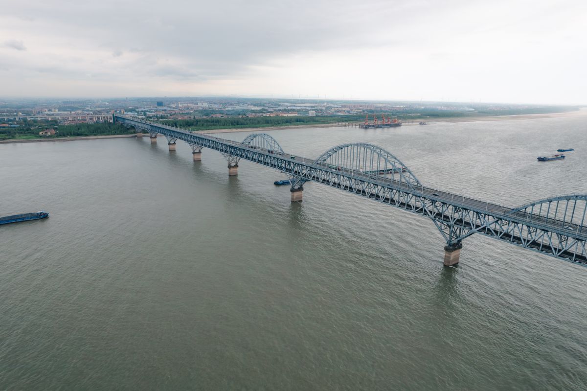
Rainy-day option: the Bridge Museum
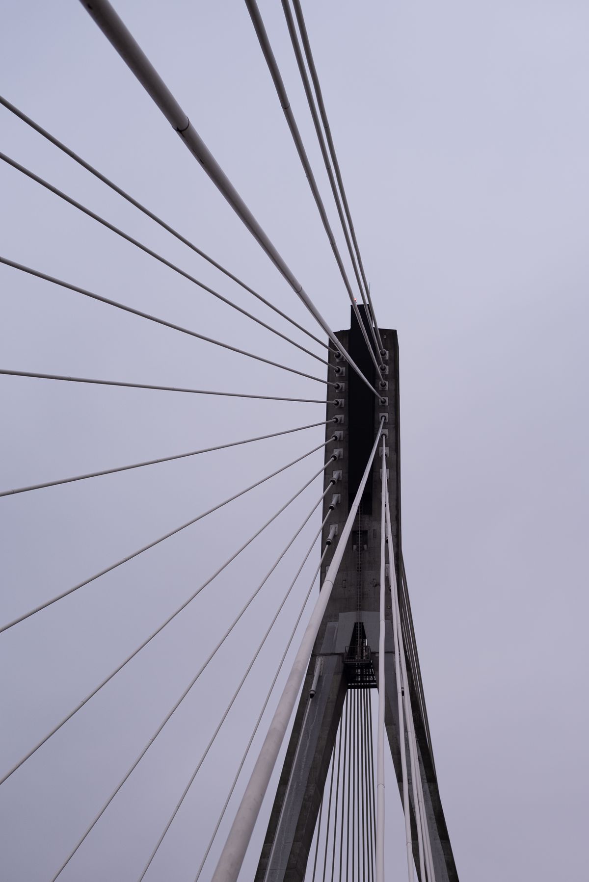
Wuhan has a museum devoted entirely to bridge building, run by the China Railway Major Bridge Engineering Group in Hanyang. Listed details: free entry with an advance reservation through its WeChat account; Monday to Saturday, 9:00–12:00 and 14:00–17:00, closed on public holidays; at 6 Sixin Avenue, Hanyang, reachable by Metro Line 6 to International Expo Center South then bus 517. It is the natural wet-weather companion to this page.
Those hours, the reservation mechanism and the address come from a secondary roundup citing provincial government and museum channels, not from a museum site we could verify (F92). We have not checked whether a foreign passport works in the reservation system, whether any signage is in English, or whether special exhibitions charge. Treat all of it as reported and confirm on the day. If it does not work out, the Hubei Provincial Museum is a verified indoor alternative.
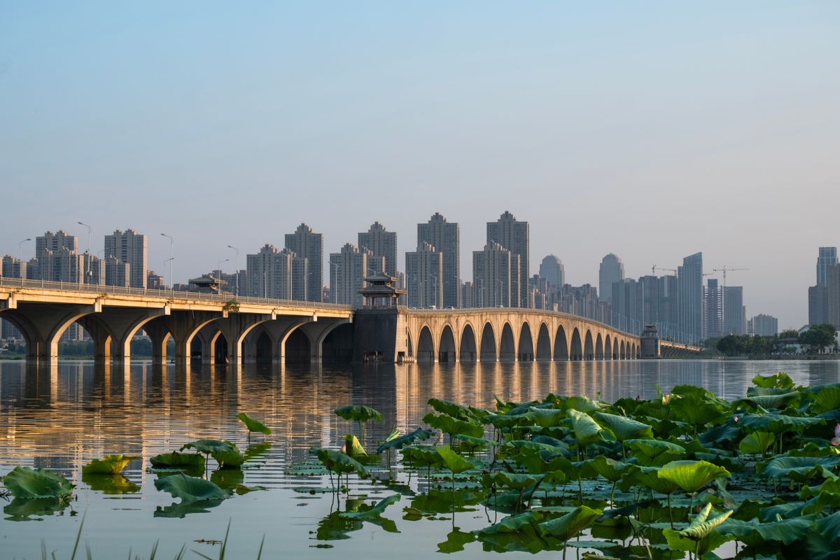
We have licensed real photographs of only a handful of Wuhan bridges — Wikimedia Commons, the obvious source for one photo per bridge, is unreachable from our build network. Rather than attach a picture of a different bridge and label it as this one, every card carries a clearly marked structural diagram. A few secondary sources also give opening dates that differ by a day or a year, and many publish "world's largest" claims we could not verify; we left those out. If you want the visual guide to every span, the honest route is a boat or a riverbank walk, not this page.
Questions we keep seeing
How many bridges cross the Yangtze in Wuhan?
Which Wuhan bridge can you walk across?
What is the most famous bridge in Wuhan?
Are the bridges lit up at night?
Is there a bridge museum in Wuhan?
Why do the pictures on this page look like drawings?
Sources, prices and currency
The count, names and opening dates follow FACTS F90: the Changjiang Daily and Hubei Daily lists published on 20 March 2026, cross-checked against the Wuhan municipal government's 2022 summary of the first eleven and an English report calling Shuangliu the twelfth. Date conflicts are noted on the cards (F90b). Bridge types, districts connected and the short descriptions follow F91, compiled from Chinese bridge inventories cross-checked against the municipal government's Yangsigang feature (F91a) and an English opening report for Shuangliu (F91b); where a span, width or superlative could not be verified against a primary source, it is not published. The Bridge Museum details are F92 and are explicitly labelled reported. F93 records that Han River bridges, tunnels and metro crossings are outside the twelve and that we could not verify a reliable count for them. Outbound references are managed in data/reference-links.json via reference markers; photographs are listed in data/image-credits.json and the source-policy ledger in data/image-sources.json. Class B: re-check the bridge count, the Hannan construction status and the museum details quarterly. See the source method.
Every CNY amount on this page is shown twice: the yuan figure you will actually see on the price board, and a US dollar conversion for budgeting. Dollar values are mid-market conversions at 1 CNY = $0.14957 (ExchangeRate-API (open.er-api.com), 12 Nov 2026), refreshed automatically when the page loads and cached for 24 hours. Your bank or card issuer will use its own rate and may add a foreign-transaction fee. Full explanation.
Checked quarterly — hours, routes and venues. This page was last checked 2026-11.